$4.99 · iOS & Android
Rail infrastructure, mapped at depth.
Pick a region, choose rail type and map mode. See speed, electrification, gauge, usage and stations. Download offline packs or use mobile data on the go. Set custom line colours and presets. Optional location shows where you are on the network.
- · 650+ regions
- · 8 rail types
- · 13 languages
RailsMaps URLs open the matching map view in the app when installed, or fall back to the web automatically.
Why rail fans use RailsMaps.
Map depth from national corridors down to station approaches — in one consistent style. Every rail type with infrastructure filtering no other mobile map offers. Download region packs for the areas you travel or study — they work without a connection.
Built on OpenStreetMap
All rail data comes from OpenStreetMap contributors — the same source as railsmaps.com. Coverage and attribute completeness depend on OSM activity in each region.
Web links open the app
Any railsmaps.com region URL opens the matching map view in the app when installed — from search results, messages or shared links. Falls back to the web when the app is absent.
See it in action
What the app gives you
Map view
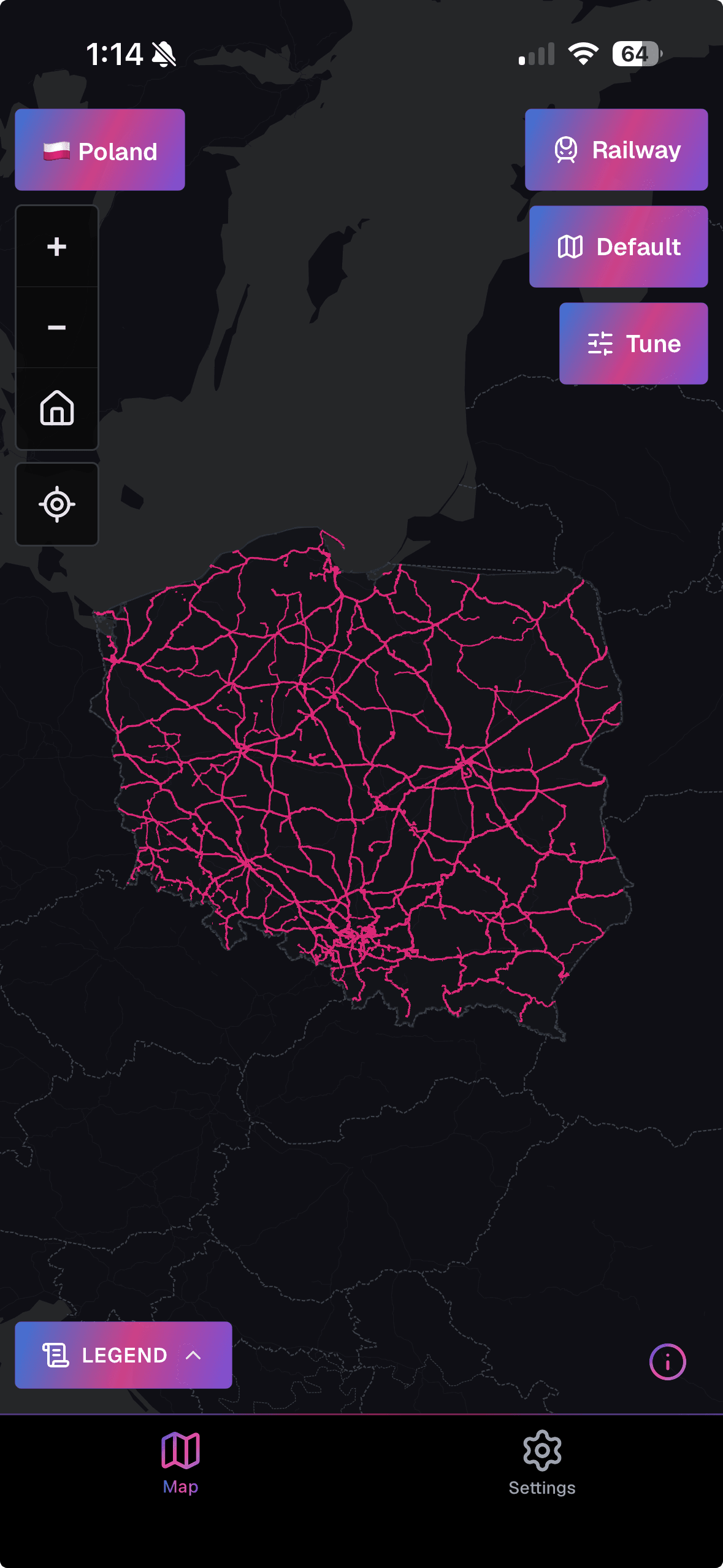
Infrastructure modes
Standard view, max speed, electrification by voltage, track gauge, usage type, high-speed corridors, stations, level crossings, under-construction, proposed and historical lines.
All rail types
Mainline railways, metro, tram, light rail, narrow gauge, monorail, funicular and miniature railways — each with dedicated modes where data exists.
Layers & appearance
Vector basemaps in auto, light and dark. Optional raster overlay. Rail layer opacity, basemap labels, country and city boundary overlays. Light, dark or follow system theme.
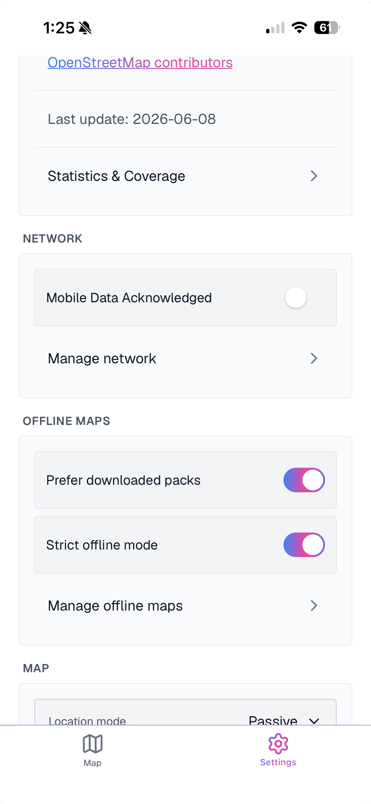
Offline maps
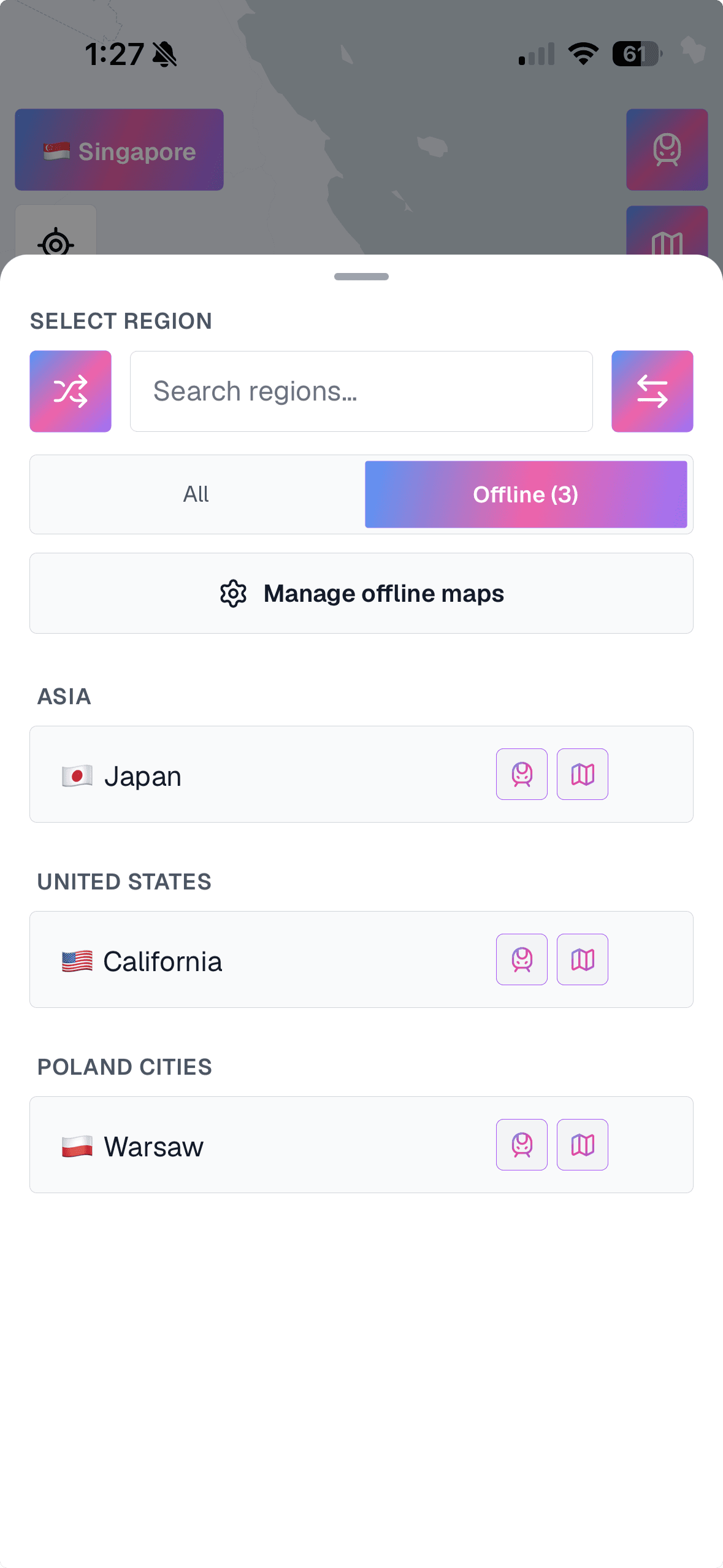
Offline region packs
Download region packs before you travel — city packs reach zoom 13 (street detail), national packs zoom 9. Pack size and zoom range shown before downloading. Updated weekly.
Mobile data control
You decide how the app uses data. Wi-Fi only, mobile data, or strict offline — your call. Strict mode blocks all network requests so the app never surprises you with unexpected data usage.
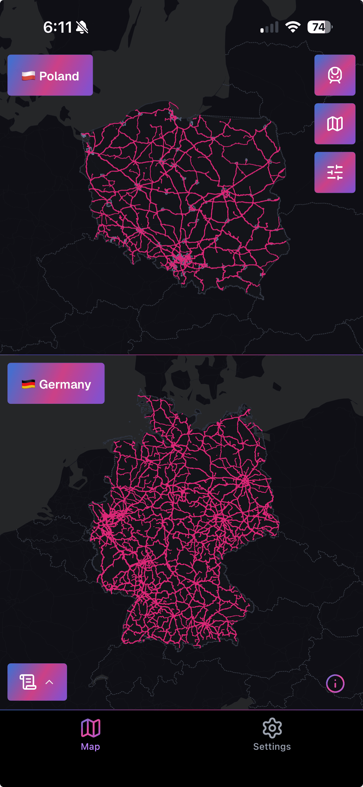
Compare regions
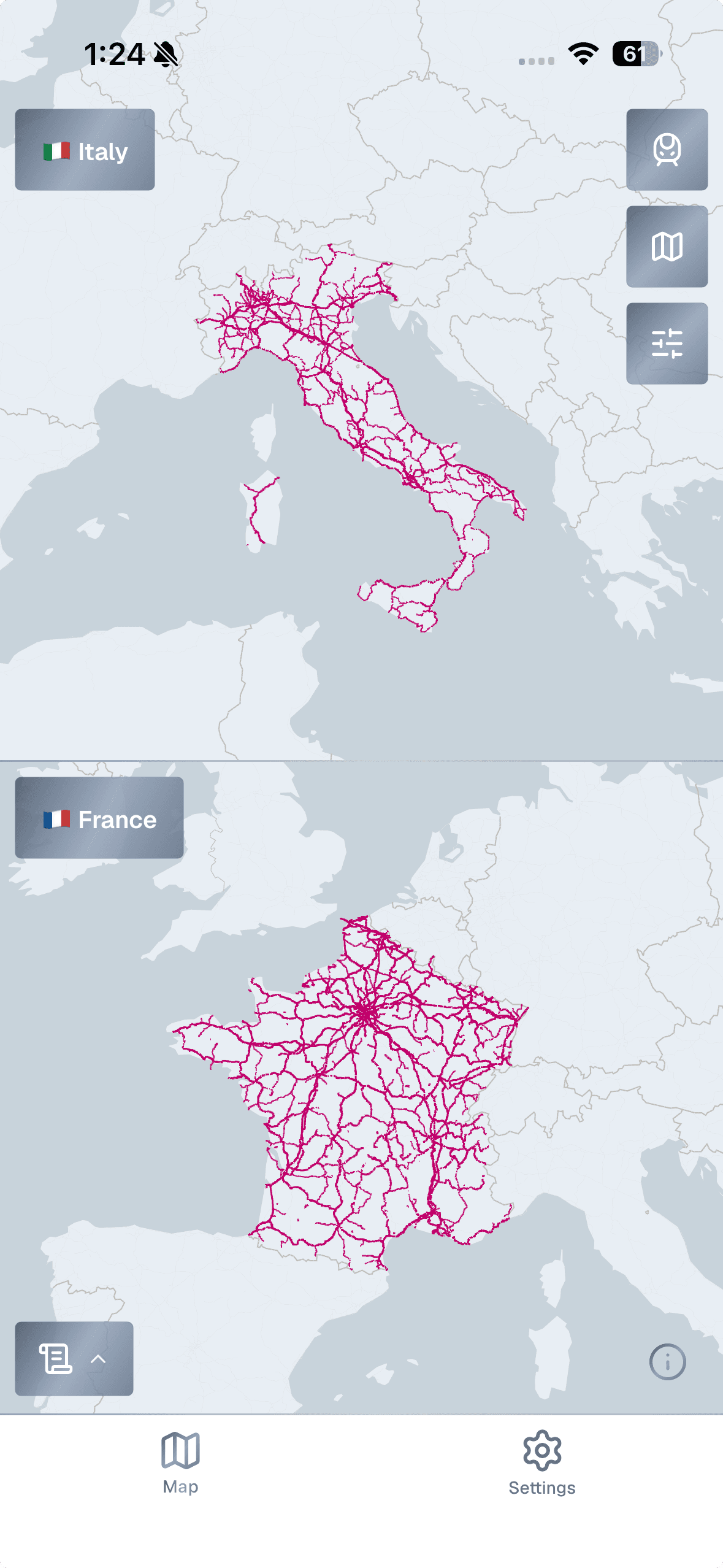
Compare two regions
Split the map to show two regions side by side with synchronised zoom and pan.
Custom map presets
Adjust rail line colors, widths and visibility per layer state. Up to 20 presets saved on device, applied separately for light and dark themes.
Line & station details
Tap any line or station to see speed, gauge, electrification, usage type and Wikipedia link where available.
Settings
Your position on the network
Passive or active location — entirely optional. See where you are on the rail network, or enable follow mode to track yourself along any line. Useful on heritage railways or when exploring historical routes on foot.
Frequently asked questions
- Does the offline feature work without downloading anything?
- The app caches recently viewed tiles automatically. For full offline use in an area, download a region pack from Settings → Offline maps before going offline.
- Does RailsMaps work without the app?
- Yes. Every public railsmaps.com URL opens on the web. The app is an additional mobile experience.
- Will search or shared links open the app?
- When the app is installed and domain verification succeeds, supported railsmaps.com map URLs open the app directly.
- Where does the data come from?
- From OpenStreetMap contributors. Attribute completeness — speed, electrification, gauge — varies by region and depends on what contributors have mapped.
- How much does RailsMaps cost?
- RailsMaps is a one-time purchase of $4.99. No subscription. Buy once, unlock all maps, offline region packs, infrastructure modes and custom presets.
- Does the $4.99 purchase include future updates?
- Yes. Buy once and all future maps, regions and app updates are included. No additional charges.
- What is the difference between the app and the website?
- The website and app share the same map data. The app adds offline region packs, a native mobile interface, custom presets saved on device and optional location tracking. The web version is accessible from any browser without installation, and will stay free forever.
- Does the app come with any web benefits?
- Yes. Sign in on the mobile app with the same account you use on railsmaps.com or freakmaps.com — that's all it takes to claim a complimentary +2-week web export pass. The pass works on both RailsMaps and FreakMaps.
Get RailsMaps on your phone
Offline-ready rail maps with full infrastructure detail. Same data as the web, designed for your pocket.
All data from OpenStreetMap contributors — detailed where the community is active, sparse where it isn't. It shows the bigger picture, not the fine print.